In celebration of Artemis II
In celebration of all that humanity can do to dream, work together, and explore, the SAM team has been engaged in the Artemis II adventure to the Moon. Thank you NASA, the Canadian Space Agency, the hundreds of contract companies and thousands of individuals who worked for years to make this possible. Thank you for giving us hope at a time when hope and unity are needed more than ever.


 - NASA astronaut and Artemis II Commander Reid Wiseman peers out of one of the Orion spacecraft's main cabin windows, looking back at Earth, as the crew travels towards the Moon.")

 – The Artemis II crew – (clockwise from left) Mission Specialist Christina Koch, Mission Specialist Jeremy Hansen, Commander Reid Wiseman, and Pilot Victor Glover – pause for a group photo inside the Orion spacecraft on their way home. Following a swing around the far side of the Moon on April 6, 2026, the crew exited the lunar sphere of influence (the point at which the Moon's gravity has a stronger pull on Orion than the Earth's) on April 7, and are headed back to Earth for a splashdown in the Pacific Ocean on April 10.")
 - Pictured from left to right, Angela Garcia, Dr. Kelsey Young, and Dr. Trevor Graff, the first science officers of the Artemis program in the White Flight Control Room in the Christopher C. Kraft Jr. Mission Control Center at NASA’s Johnson Space Center. Seen here about ten minutes before Earthset during Artemis II, these science officers are seen monitoring mission data in real-time from the Science console. They support flight controllers by analyzing scientific measurements and system performance. Their work helps ensure mission objectives are achieved safely and efficiently. Credit: NASA")
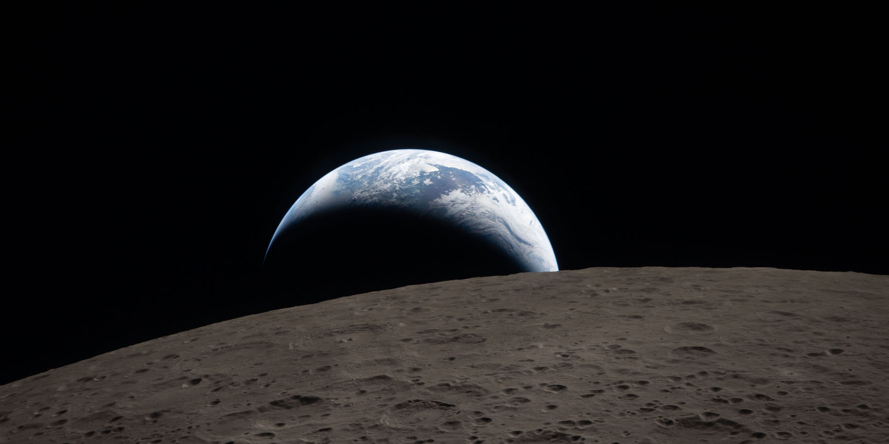
 - A view of the nearside of the Moon, the side we always see from Earth. Some of the far side is visible, as well, on the left edge, just beyond the black patch that is Orientale basin, a nearly 600-mile-wide crater that straddles the Moon’s near and far sides and is partly visible from Earth. The dark areas in the center and right side of the disk are ancient lava flows, which are unique to the near side of the Moon. The white dot at the bottom of the disk, with white rays shooting out from it, is Tycho crater, one of the younger craters on the Moon at 108 million years old.")
 - The Moon, seen here backlit by the Sun during a solar eclipse on April 6, 2026, is photographed by one of the cameras on the Orion spacecraft’s solar array wings. Orion is visible in the foreground on the left. Earth is reflecting sunlight at the left edge of the Moon, which is slightly brighter than the rest of the disk. The bright spot visible just below the Moon’s bottom right edge is Saturn. Beyond that, the bright spot at the right edge of the image is Mars. Credit: NASA")